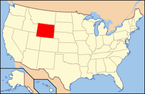
The Great Plains meet
the Rocky Mountains in Wyoming. The state is a great plateau broken
by a number of mountain ranges. In the northwest are the Absaroka,
Owl Creek, Gros Ventre, Wind River and the Teton ranges. In the
north central are the Big Horn Mountains; in the northeast, the
Black Hills; and in the southern region the Laramie, Medicine Bow
and Sierra Madre ranges.
Wyoming is an arid state
with much of the land receiving less than 10 inches (25 cm) of rainfall
per year. Consequently, the land supports few opportunities for
farming. Ranching is widespread, especially in areas near the numerous
mountain chains. The Snowy Range in the south central part of the
state is an extension of the Colorado Rockies in both geology and
appearance. The Wind River Range in the west central part of the
state is remote and includes Gannett Peak, the highest peak in the
state.
The Big Horn Mountains
in the north central portion are somewhat isolated from the bulk
of the Rocky Mountains. Old Faithful GeyserThe Teton Range in the
northwest extends for 50 miles (80 km) and represents the most impressive
section of mountains in the state. It is home to Grand Teton, the
second highest peak in Wyoming, and to Grand Teton National Park,
which preserves the most scenic section of the Teton range.
Several rivers begin
or flow through the state, including the Yellowstone River, Powder
River, and the Snake River. The Continental Divide forks in the
south central part of the state. The waters that flow or precipitate
into this area, known as the Great Divide Basin, do not flow to
any ocean. Instead, because of the overall aridity of Wyoming, they
simply sink into the soil or evaporate. Rivers east of the Divide
drain into the Missouri River Basin and eventually the Atlantic
Ocean. They are the Platte, Wind, Big Horn and the Yellowstone rivers.
The Snake River in northwest Wyoming eventually drains into the
Columbia River and the Pacific Ocean, as does the Green River through
the Colorado River Basin.